A new angle on Dorset
James Loveridge takes stunning shots of Dorset’s most beautiful locations from the air. Here he explains the challenges and success of drone photography.
Published in September ’19
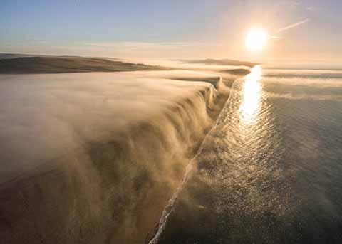
A beautiful sunrise at West Bay and Burton Bradstock with fog rolling off the 150ft clifftops and onto the beach below like a waterfall
If, when driving down a country lane in Dorset in spring or summer, you have ever wondered what was on the other side of the hedgerow, you have inadvertently identified one of the great drawbacks of traditional photography: You can only get a view from where you are on the ground.
This, though, is not a problem that James Loveridge has to deal with, as evidenced by his stunning shots of Dorset. These images of iconic locations, but taken from a position that would be impossible if he were using his Digital SLR, were possible because he uses a remote control drone to get a new angle on Dorset.
It’s just over five years since he first started taking landscape photos with a friend in their spare time, while doing a Masters Degree at Plymouth University.
In mid 2014, he started a six-month contract working in marketing for a West Dorset holiday park business and, after a while, he suggested they might get a drone. The idea was to show in a photograph just how close their holiday properties were to the coast – images that could only be taken from the air.
After the initial success of that concept trial, James eventually upgraded to the DJI Mavic 2 Pro that he uses today. The Mavic, which folds down to a compact and easily portable size, allows him to capture 20 Megapixel images that can be used up to A2 in size.
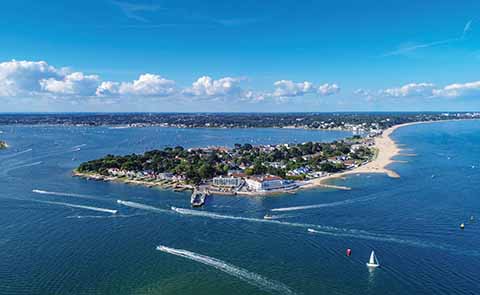
A view over the millionaire’s playground of Sandbanks and Poole Harbour
Anyone can buy a drone and take aerial shots, but in order to do so commercially, James had to obtain a Civil Aviation Authority licence. As well as a three-day course in Chepstow, during which the UK’s complex aviation laws regarding drones are learnt, there’s also a flight test to ensure that James could safely operate his drone. Finally he had to draw up (and have approved) an operations manual that laid out how he would use a drone. This last element took him a good deal longer than the other parts of the licensing requirements, and so it is only this year that he has been able to include drone-shot images in his 2020 calendar (including a number in this feature).
James normally gets about 20 minutes of flight time on one battery, so he spends a good deal of time planning his shoots using Google Earth and photography apps like The Photographer’s Ephemeris to determine the direction of sunrise and sunset from any location. He can fly his drone up to 500m from his position, but is limited to a ceiling of 400 feet, and he must never fly his drone any closer than 50m from any person, structure or vehicle of which he is not in control.
His favourite shot is our lead-off image of the fog waterfall over the cliffs at West Bay. James had determined to take an image similar to fog rolling over a mountain in a video he’d seen that was shot in Iceland. One October morning, after a cold, clear night, the forecast looked promising for fog and the conditions at sunrise were perfect. A weather phenomenon known as a temperature inversion and a slight wind flowing towards the sea, meant the fog rolled off the 150ft clifftops onto the beach below and James was rewarded with the shot you see.
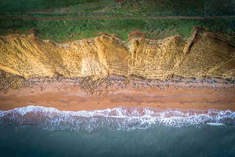
Looking straight down gives an unusual perspective of the golden cliffs and beach at West Bay
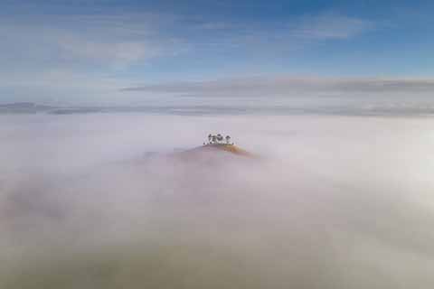
Early morning fog envelops the Marshwood Vale, leaving the tree covered hilltop of Colmer’s Hill poking out
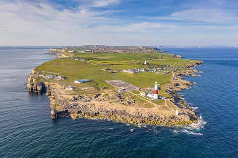
Pulpit Rock and the lighthouse at the rocky outcrop of Portland Bill
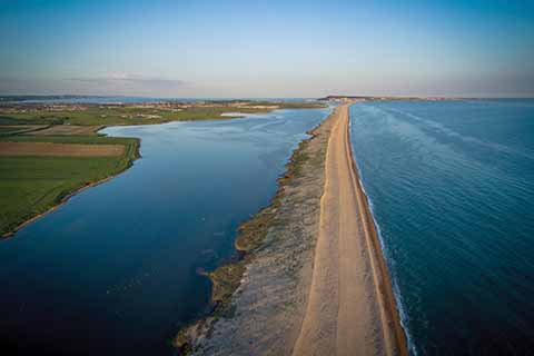
A sunset view over Chesil Beach and the Fleet Lagoon, looking towards Weymouth and Portland.
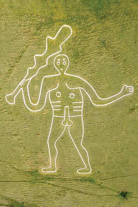
The 180ft Cerne Abbas Giant that is sculpted into a chalk hillside in the heart of Dorset is best seen from above
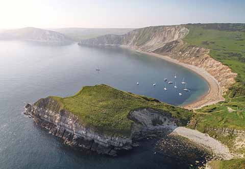
Shooting from above allows the inclusion of the Worbarrow Tout and the sweeping beach of Worbarrow Bay
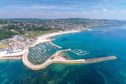
The unmistakable shape of the impressive Cobb harbour wall and beaches at Lyme Regis
James has taken plenty of photos across Dorset but still has places to visit: ‘There are areas of North Dorset I’d like to explore more and places to revisit like Mupe Bay and Hengistbury Head.’
www.jamesloveridgephotography.co.uk
