The Dorset Walk Duncliffe Wood and East Stour Common
Paul Quagliana takes a stroll around one of Dorset’s ancient woodlands
Published in June ’19
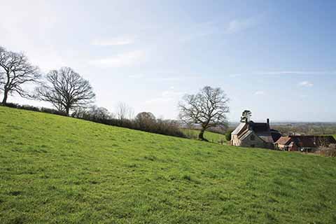
Skirting the edge of Duncliffe Wood at the beginning of the walk
Those who do not live in the Stour Valley may well have first come across Duncliffe Wood either in Chapter 4 of the fourth part of Thomas Hardy’s Jude the Obscure, or the final verse of William Barnes’s ‘Shaftesbury Feäir’ poem. Barnes wrote of looking down from Shaftesbury:
‘While Paladore, on watch, do straïn
Her eyes to Blackmwore’s blue-hill’d pläin,
While Duncliffe is the traveller’s mark,
Or cloty Stour’s a-rollèn dark…’
For those who do live in the Stour Valley, as they leave Shaftesbury heading west to East Stour on the A30, the glorious sight of Duncliffe, with the vale beyond, is a sign that they are nearly home, and one of which they will never tire.
The wood itself has been around for a while. The Domesday Book of 1086 shows it was owned at that time by Roger de Belmont and valued at nine pounds. Later it was owned by a French nunnery, became Crown property in 1414, was a gift to Eton College made by Henry VI in the 15th century, and finally conferred upon King’s College, Cambridge, by Edward IV about half a century later. It is now owned and run by the Woodland Trust and is around 225 acres in size (92.2 hectares) and its highest point is 680 feet (210m) above sea-level. It is rich with moschatel, primrose, wood anemone, celandine, wild garlic and bluebells in spring, with dog violet, yellow archangel, wood speedwell and herb Robert in late spring-summer. The rise to the summit is a riot of foxgloves throughout the summer.
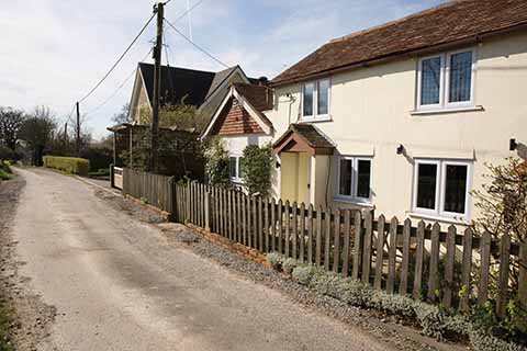
The hamlet of East Stour common
Section 1 Duncliffe car park to wood
Park in the car park and walk up the long, straight gravelled track towards the wood. Shortly before the wooden gate into the wood there is a metal gate in a hedge on the right. Go through the metal gate and follow a worn grass path, keeping the wood on your left with a large grass field with a few large oaks on your right. You will come to a wooden stile and some wooden fencing on its right. Go over the stile and continue ahead. You will see buildings off to your right. You will come to another wooden stile with a large rock/boulder on the other side of it. Go over it and follow a fence line on your right. The fence turns sharp right. Leave it behind and continue ahead. You will come to a farm track running right to left with a double wooden stile. Go over these and continue with a hedge and fencing on your left. Keep going and you will see a metal gate on your left and a wooden gate and fencing ahead. Go through the wooden gate. An earth path curls to the right and after a few yards you will face an open field. Turn left here and follow the narrow earth/grass path to the wood, keeping a hedge line on your left.
The Trig point at the top of Duncliffe Hill
Section 2 The wood
The earth path enters the wood and you will see wooden fencing and a wooden kissing gate straight ahead. Go through the kissing gate and past a sign with a map of Duncliffe Wood on it. There is a small earth path to the right and two broad gravelled tracks ahead. One curls to the left; ignore it and take the right-hand one straight ahead. The gravelled track continues for some distance and you will pass a pond on your right next to a field. The track heads downhill and then up, passing a wooden bench and with a wooden barrier ahead. Here it meets another gravelled track going right to left. Turn right here and shortly pass a gravelled area on your left. Continue until you see a wooden gate on your right into a field, a gravelled track that turns sharp left uphill and an earth path in the middle. Take the earth path that leads gently uphill inside the wood with a field on your right. You will come to a wooden barrier and a wooden gate on the right. The path curves round to the left – keep following it. The path gets deeper and about halfway up you will see a path to the left. Ignore it and keep going uphill. At the top the path curls to the left. Pass a bench on your left and go through a wooden gate just beyond it. Pass a wooden gate on the left with a path downhill and keep going forwards. Pass a triangulation station on your right and go through a wooden gate beyond it. The path now descends steeply and crosses a broad gravelled track. Stay on the earth path and keep heading downhill. The path curls to the left and you will see a wooden gate on your right into a field, wooden barriers and a path heading downhill just inside the boundary of the wood. Follow the path downhill just inside the wood. The path splits; stay on the right-hand path which then leads into a field and young plantation. You can turn left here but instead continue, keeping the hedge on your right, and in a few yards you will see a metal gate on the right. Go through this.
Section 3 Pennymore Pitt Farm to small wood
Proceed with a hedge on your left and large field on your right. You will see a wooden telegraph pole ahead and here the hedge turns sharp left. Leave it behind and continue straight ahead towards the Pennymore Pitt farm buildings. Cross a double stile in a hedge. You will now have a hedge on your right. Stay close to it and keep going. You will come to a metal gate on your right and one straight ahead beyond which are the farm buildings. Go through this gate and work your way around the farm buildings, keeping home on the right of you. You will enter the farmyard on a broad track and see a metal gate with a wooden stile on the right. Go over the stile. Shortly there is another metal gate with a wooden stile on the left. Go over it and you are facing the busy A30 – take care! Turn right, walking along the edge of the A30, passing the farm and a pond on your right. The road rises and curls gently to the left and on the rise is a footpath marker and a track on the left. Cross the road and follow the track. The track is grass and earth and soon meets a metal gate with a wooden telegraph pole beyond. Go through the gate and, following the telephone wires and keeping a tall hedge and trees on your left, head to the bottom of the field. In the bottom corner on the left is a metal gate. Go through it and a few yards ahead is another metal gate with a short section of wooden fencing on the left of it. Keeping a hedge on your left and a field on your right, follow the hedge to another metal gate. Go through this. You are now in a large field with a hedge and fencing on your right. Keep following the hedge for a distance, pass Cowslip Farm visible through the hedge and shortly face a wooden stile. Do not go over the stile but turn sharp left and follow a fence with a young tree plantation behind it. Keep going gently uphill to some buildings and telephone poles. Keeping them on your right, keep working around the edge of the field. You will come to a short wooden bridge with a metal gate beyond it. Go through the gate and you will be on a narrow path through woodland. Keep on the path as it leaves the woodland and becomes grassy.
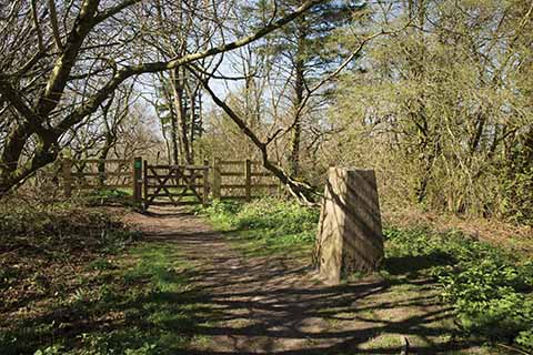
Leaving the wood again to head for East Stour Common
Section 4 Toad Cottage to Duncliffe car park
The path becomes a broad, heavily rutted grass track with a hedge either side. It briefly becomes gravelled and then asphalted as you pass Toad Cottage and other buildings on your right. Keep going until you meet the King’s Arms Inn. Take the crossing over the A30 and continue ahead down the road back to your car.
Distance: 4.6 miles
Terrain: Flat to begin with then steep-ish climbs and descents around the summit of the hill. Generally good underfoot, but hill paths can be muddy in wet weather.
Start: Duncliffe Wood Car Park. Hawkers Lane, Stour Row. OS Reference ST817222. Postcode SP7 0QJ
How to get there: On the A30 from East Stour, travel 1.4 miles east towards Shaftesbury. From Shaftesbury, travel 3.4 miles west towards East Stour. After, turn into New Lane. In two-thirds of a mile the car park is on your left, just after passing New Gate Farm.
Maps: OS Explorer 129 (Yeovil & Sherborne) and Landranger 183 (Yeovil & Frome)
Refreshments: Kings Arms Inn, East Stour Common (on route). The Udder Farm Shop (1/3 mile west of start of New Lane on A30), The Crown Inn, East Stour (0.4 miles west from start of New Lane along A30, then right into Browns lane for 0.4 miles)
