Dorset walk – Sturminster Newton, Manston, Hammoon & Fiddleford Mill
Paul Quagliana put his wellies on for a proper North Dorset walk
Published in April ’19
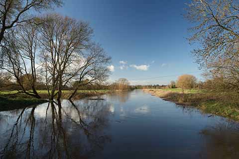
The Stour is Dorset’s most significant river
The River Stour is to Dorset what the Mississippi is to the United States. It is perhaps not as long, as wide or as powerful, but it is just as prone to flooding, so bear this in mind for some of this route. Watch the weather before taking the walk, or you might wish you had worn waders.
It is a pleasant, largely flat walk that starts in Sturminster Newton, heads out across pasture and open fields to St Nicholas’s Church, Manston, and goes through Hammoon and along the North Dorset Trailway, passing Fiddleford Mill.
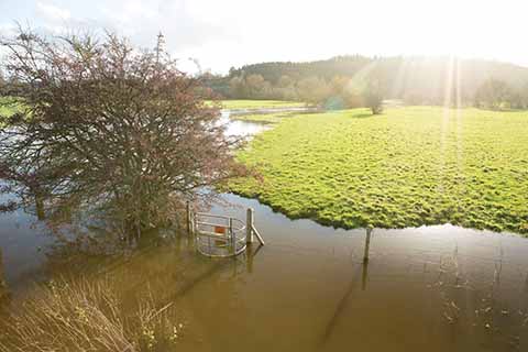
Some of the optional extensions to the walk may be inaccessible after long periods of rainfall
THE WALK
1 Walk uphill from where you have parked on Rixon Hill. As you approach a sharp left bend you will see a Railway Path sign on your right. This will ultimately be your return point. Pass the sign and on the bend you will be faced with a metal gate, go through it and down a path for about 40 yards to another metal gate. Go through it and continue ahead for about 100 yards on a gentle downward slope with a hedge and short trees on your right. You will come to a wooden bridge over a brook with a metal gate at either end. Go over it and follow the hedge for a short distance, keeping it on your left, and you will see a footpath marker to Manston Church. The footpath is not visible but follow the direction of the sign across the field for about 300 yards. You will come to a raised stone and red brick bridge in the hedge. Go over it. Continue ahead, keeping a hedge with gaps and oak trees in it on your right, with a large grassy field on your left. After a distance the hedge turns sharp right. On this corner leave the hedge and follow a footpath marker downhill across the field with the river in the distance. Keep going and you will see another footpath marker pointing towards a hedge line at the bottom of the slope. Head for this. In the hedge you will find a wooden bridge and two stiles. Go over this. Look left and you will see a footpath marker pointing in the direction of Manston. The route will take you to another raised red brick and stone bridge over a stream. Go over it and continue with the River Stour on your right through a very long pasture field. In the distance you will see a building with a red roof. Head for this, slowly veering right to bring you closer to the river. The footpath is not visible here. As you approach the red-roofed building, the footpath becomes visible with a fence on its right. You will come to a wooden gate right next to buildings. Go through it and turn left almost straightaway – avoiding a log pile – and you will immediately see another wooden gate. Go through this and up a tarmac lane for about 60 yards and you will meet the road. Turn right.
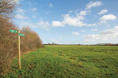
A stretch of open field walking on the way to Manston Church
2 On turning right, you will see the road bending sharply to the left. On this bend is a black metal gate with ‘Manston Church’ signed on it. Go through this gate. You will see two black metal gates ahead. Go through the left one, which is secured with a clip chain. Go through it and walk about 150 yards, veering very slightly left towards a wooden fence and a stile. Go over the stile and continue for about 50 yards to another wooden fence and stile – go over this. Head for the bottom left-hand corner of the field in front of you, where a small gap should be visible about 200 yards away. On reaching the gap, cross a wooden bridge with a stile at either end. After crossing, continue ahead towards some power lines, trees and hedge. Go through a metal gate and over a wooden bridge. Turn right onto the road. Pass over Hammoon bridge, past the Hammoon sign and at a crossroads stay on the road and keep going ahead, passing the church on your right. Keep following the road until you reach a slight rise. You will see signs for the Trailway – turn right here.
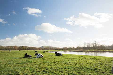
Riverside pastureland is a theme of this walk
3 Follow the Trailway until you get to the bridge over the River Stour below Fiddleford Mill. Here you have a choice. You can leave the Trailway and have a look at the mill pool and also follow a route across fields that loops back to the Trailway and rejoins the final part of this walk, or you can simply stay on the Trailway. Due to flooding the choice was made for me! Keep going on the Trailway and you will pass a sewage works on your right and after this, a small bridge with low brick sides and metal railings
4 Peek over the right-hand side of the bridge and you will see a small wooden gate and a path that leads away to the left between houses or a path to the right that skirts around the houses. Go down some steps and take the right path. Follow it for about 80 yards to a hedge corner and a metal gate. Go through the gate and follow the earth path. The path cuts the corner off the field and heads slightly uphill to a metal gate just short of a hedge corner with an old barn behind. Go through the gate and you are now on a grassy gentle uphill path. Follow it until you meet a track. Go over the track, between some small wooden barriers, and the narrow path now becomes gravelled, winding along with wire mesh fencing on the left. Keep going and it will bring you to Rixon Hill and your vehicle.
Distance: About 4.6 miles.
Terrain: Mostly on field paths and tracks, the going underfoot is weather-dependent and there are few climbs of note.
Start: Rixon Hill, Sturminster Newton. OS reference ST793144. Postcode DT10 1BG.
How to get there: In Sturminster Newton follow the signs for the B3091 and park at the side of the road on Rixon Hill B3091 before it becomes Manston Road.
Maps: OS Explorer 129 (Yeovil & Sherborne), OS Landranger 194 (Dorchester & Weymouth) and OS Landranger 183 (Yeovil & Frome) for a short section around Manston.
Refreshments: None on route, but a spur can be made at Fiddleford down to the Fiddleford Inn. There are also cafés and pubs in Sturminster Newton.
