The Dorset walk – Dewlish and Cheselbourne
Matt Wilkinson on the Dorset Downs
Published in March ’19
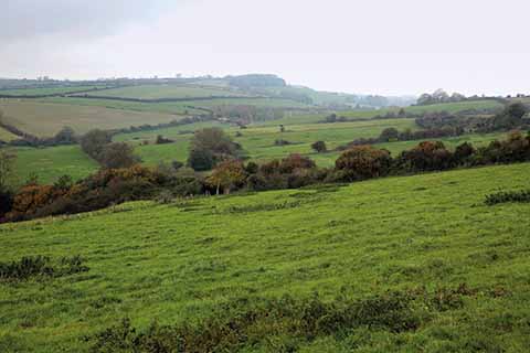
Vistas open up as you go along the walk through hedgerows into wider fields
We owe the beautiful landscape of mid-Dorset to the chalk formation that sweeps across southern England, entering the county at Cranborne Chase and continuing down to Eggardon Hill and the Ridgeway. It is a landscape of huge arable fields on gently rolling hills, cut through by river valleys running north-south, and in decent weather it can hold its own with anywhere else in Dorset as the setting for a rewarding walk.
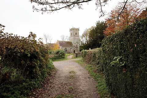
St Martin’s Church in Cheselbourne
This route visits the valleys of the Devil’s Brook and of the two unnamed streams to the west. The Devil’s Brook gives its name to Dewlish – or possibly vice versa – which is a village notable for its position, huddled beneath a wooded hill, and its Queen Anne manor house, built on the site of a Roman villa which had a mosaic of a leopard leaping on a gazelle. The village was on the main road from Dorchester to Blandford, and thence to London, until about 1750, when the present A354 was built. All Saints church has two Norman doorways and a Norman font, as well as a memorial to Field Marshal Sir John Michel, who captured and burnt the Old Summer Palace in Peking during the Second Opium War in 1860.
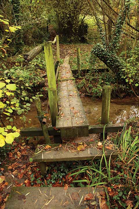
Bridges don’t come much more rustic than this one over the Devil’s Brook
Cheselbourne has had a quieter history, but used to be the site of a tradition known as ‘treading in the wheat’, in which young women from the village would walk the fields on Palm Sunday, dressed in white. It also has the distinction that its village school is the smallest recognised school in Dorset.
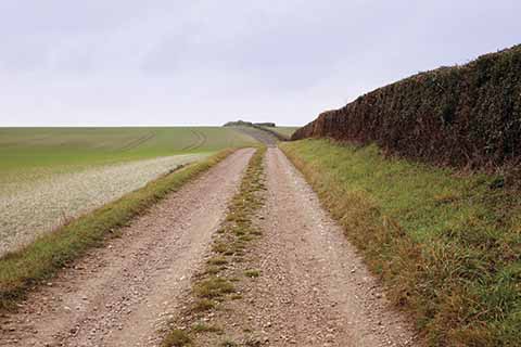
Strolling along the Dorset Downs
THE WALK
1 Walk up to the cross-roads and turn right. In about 350 yards, just after a house with handsome sculpted topiary in its front garden, bear right through a gate. The right of way goes diagonally across the field but it is as easy, and kinder to the crops, to walk down to the bottom of the field and turn left to walk along to two houses on the right. Shortly after these, follow the field-edge round to the right and in about 40 yards, strike off left to close gradually with the what is now the right-hand edge of the field. Look out for an opening in about 150 yards and go through it to cross two bridges and climb up a slope.
2 At the top of the rise turn left on a track. Stay on this as it climbs but at the top of the rise it bears right; here continue straight ahead on a more grassy track. Go over a bank into the next field and bear slightly right to a gate about 50 yards down from the far right-hand corner. In the open field beyond, continue in the same direction, along the right-hand edge, for about 250 yards to a metal gate on the right.
3 Here turn left, downhill across the field, and head for a metal gate right in its bottom right-hand corner. Continue in the same direction through a patch of undergrowth and follow the right-hand field-edge, still heading downhill. About 100 yards before the bottom of the hill, go through a gate on the right and follow the left-hand edge of two fields to reach a lane. Turn left and walk down to a T-junction. Go straight across to the right-hand of two gates, then follow the left-hand field-edge up the hill and over a track to a lane.
4 Turn left and walk down to a T-junction with the road that runs through Cheselbourne. Turn left and walk through the village. Between Copse Cottage and Church Cottage, take a track that runs off to the right, alongside a stream. In front of the gate into the churchyard of St Martin’s, turn right. The path soon runs between two fences with open fields on either side, to reach a track. Here turn right. At the end of the field, stay on the track, which bends to the right, then turns sharply left to head down the left-hand side of a large field.
5 Pass beautifully positioned Westdown House, then continue in the same direction up the right-hand edge of the next field. The track kinks right and left to run between hedges to a T-junction with another track. Turn left and follow the new track as it bends right in the first corner, but almost immediately turn left and then right, off the main track, to follow a minor track downhill, following the hedge on the right. At the bottom of the slope bear right, along the bottom of another open field, and in the first corner go left, over a stream.
6 Take the grassy track that curves away to the left, running alongside a hedgerow with an open field on the right. The track descends and becomes a path before going through a metal gate into Dole’s Hill Plantation. In a little over 300 yards, a path runs off to the left, across the stream and up the right-hand edge of a field. Follow this as it curves gently to the right, then bends to the left and goes uphill. In the next corner, continue ahead on an enclosed path. At a fork, take the right-hand option and continue between the hedges. The path becomes a track which eventually emerges onto a lane.
7 Turn left, then take the first turning on the right. In 70 yards, cross a stile on the right and initially follow the left-hand field-edge, but as soon as it bends slightly to the left, carry on in the same direction to climb the slope diagonally to a corner where the fence at the top of the field bends round to the right. Follow this fence towards the phone mast, where go through a gate and turn right on a lane. Walk down into Dewlish and straight over the cross-roads to your car.
Distance: About 7 miles.
Terrain: Mostly on field paths and tracks, the going underfoot is generally good, give or take the occasional muddy patch in the valley bottoms. The undulating nature of the landscape creates plenty of climbs and descents, most fairly gentle.
Start: Outside Dewlish village hall, opposite the entrance to the churchyard of All Saints. OS reference SY775982. Postcode DT2 7LU.
How to get there: From the A354 Dorchester-Blandford road, turn west just on the Dorchester side of the Royal Oak pub. Follow the road into and through Dewlish. The church and village hall are just after a sharp right-hand bend.
Maps: OS Explorer 117 (Cerne Abbas & Bere Regis), OS Landranger 194 (Dorchester & Weymouth).
Refreshments: The Oak at Dewlish is near the start/end of the walk.
