Verwood: then & now in pictures
Joël Lacey tries to reconstruct century-old photos of Verwood to see how the town has changed
Published in February ’19
In the context of a human life, a century is an awfully long time, although there are probably as many centenarians in Verwood per capita as anywhere else in the country.
In the lifetime of many towns and villages in Dorset, though, a century may not really be that long. Some have churches that date back ten times that long. For Verwood, however, a century really is quite a long time, and there’s no doubt that its population and housing has exploded over the last 190 years. Its population was 400 in 1829, 1200 a century later and has expanded tenfold since then, with somewhere in the region of 15,000 people living in the civil parish (which includes Three Legged Cross).
As with many Dorset towns, the railway came in like a lion (Verwood was the first Dorset station on the Salisbury to Poole line, opening in the year 1866) and went out like a lamb under the axe of the Beeching review (it closed to passengers in 1964 and to passengers a year later in 1965, tantalisingly short of its centenary).
With the railways came more souls and the number of churches in Verwood grew to match the pastoral needs of the various flocks. The primitive Methodist church in Vicarage Road was built, then demolished and rebuilt much bigger. St Michael and All Angels was built in 1886 then rebuilt just shy of a century later. As time passed, so the nature of employment in the area changed.
There had been potters since the 18th century and no doubt before, but the area became known for its pots and potters.
With the industrial revolution came significant housing expansion and Verwood’s clay started to be used to make bricks on a massive scale. There is no doubt that, despite the presence of a few cob houses here and there, brick is the predominant building material in town.
Verwood’s location has more recently made it primarily an attractive proposition as a place to live. In essence, whether the population is 400, or forty times 400, that much has not changed about Verwood over the last 190 years, no matter how the scenery may have evolved.
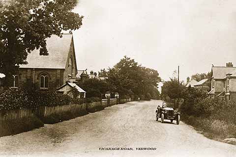
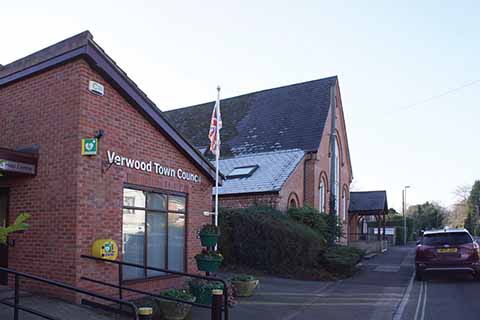
Vicarage Road, once a through road is now a cul-de-sac that is also home to the Town Council. Credit top: www.barriepictures.co.uk
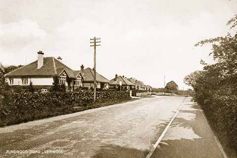
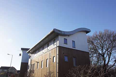
This is a slightly different kind of ‘then and now’ comparison in that it concerns the two opposite ends of town rather than the same place, but the images demonstrate the changes in the nature of building design: villa-style buildings popular in 1910 and 21st-century winged-roof apartment housing. Credit top: www.barriepictures.co.uk
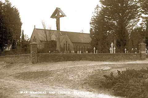
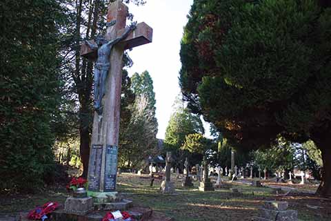
The old wooden war memorial outside St Michael and All Angels Church in Verwood blew down and was replaced with a re-erected Portland stone version (featuring the original Calvary) and which is now between the pre- and post-World War 2 graveyards. Credit top: www.barriepictures.co.uk
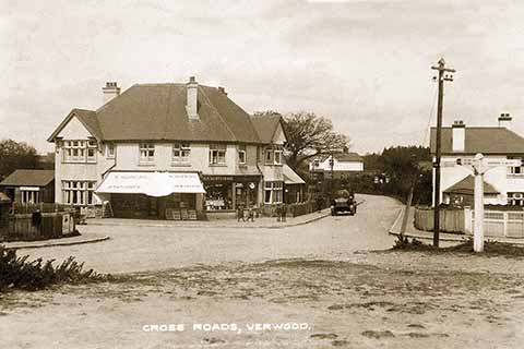
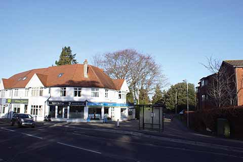
Nelly Hopkins and her stationer’s and newsagent’s store may be long gone, and the crossroads no longer even be a crossroads, but the building’s eye-catching design still makes this easily recognisable as the same place, 100 years on. Credit top: www.barriepictures.co.uk
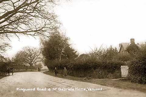
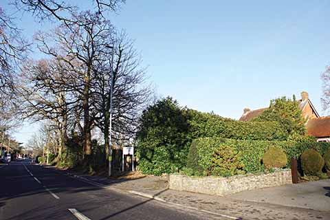
On a quiet winter’s day in modern Verwood it is tempting to close one’s eyes and think back to times when young boys tapped their hoops along the main Verwood-Ringwood road as a solitary horse and a mother and child look on. Credit top: www.barriepictures.co.uk
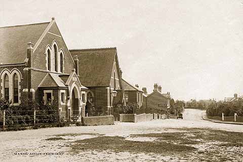
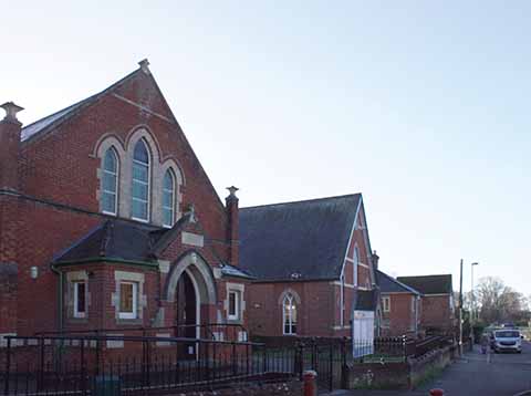
The buildings of Verwood’s United Reform Church and what is now the town library have barely changed in a hundred years. Credit top: www.barriepictures.co.uk
