The Dorset walk – Stephens Castle, Pistle Down, Mount Ararat and Wild Church Bottom
Paul Quagliana climbs up one of the best viewpoints in East Dorset
Published in May ’19
The path forks, take the right fork with telephone wires on your right
This walk takes us up to a relatively modest height of about 80 metres above sea level, but nonetheless offers the chance to look south and south-west as far as the Purbeck Hills on a clear day and west over the conurbation of Verwood. It also combines four of the best Dorset place-names since the opening lines of John Betjeman’s poem Dorset, albeit their names are either misleading or recent constructs.
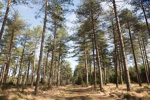
The track stays flat through the Scots pines
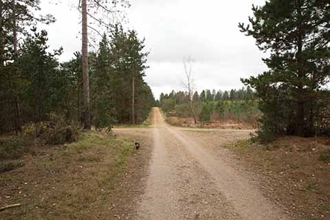
One of a number of cross roads you will come to. In this case, go straight over and keep going.
There is no Castle at Stephens Castle, just a barrow and a quarry. Dorset’s Mount Ararat is not 3611m high, like the one in the east of Turkey where Noah’s Ark is said to have come to rest, but 3541m shy of that height. Pistle Down derives its name from the word epistle, or letter, and is thought to date from when biblical texts were read out during the beating of the bounds, and Wild Church Bottom doesn’t have a church and at only barely 20 metres lower than the land that surrounds it, hardly a bottom. It is wild, though.
This is a sprawling forest and heathland walk that requires a certain amount of attention to be paid to the route as paths criss-cross the walk at many places.
THE WALK
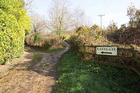
1 Take the broad track on the left of the Verwood Concert Brass Band Hall. The track climbs gently with a wooden fence on your right. You will soon come to a wooden gate, a wooden kissing gate and a sign for Stephens Castle. Do not go through it. Take the narrower path to the left of it that has large trees next to it on the left and holly bushes on the right. Keep going up a gentle slope with a wooden fence running along the path on your right. The path forks around a few trees in the middle: take the right fork with the wooden fence next to you. The path opens up to meet a track with a wooden gate on your right and laurel bushes straight ahead. Turn right up the track. The track is signposted to Alderholt and has a wooden fence running along it on the right with telephone wires on your right. The path forks: take the narrower right fork with telephone poles on your right. The path curls slightly right up a gentle slope with a wooden fence on your right. You will see a metal kissing gate on your right and a sign for Stephens Castle. Go through the metal kissing gate and turn immediately right onto a narrow earth path. Follow it until you meet a cross-paths. Go left and this will shortly lead to a viewing point. Retrace your steps to go back to the metal kissing gate then turn right.
2 Continue up the track and you will come to a green barrier. Go straight ahead, ignoring a right turn immediately after the barrier. Continue straight ahead, ignoring any turnings and passing tall Scots pines on your left and lower trees on your right. The track broadens, curling gently to the right. It forks here: take the left fork marked with a post and blue footpath arrows. This is a narrower, gravelly track that soon meets a boggy area on the left. Keep following the track going round the boggy area. The track briefly becomes an earth path through trees and then broadens out into a track again. The track stays flat with tall Scots pines on either side. It curls gently to the right and a large open area will appear on your left. The track reaches a grassy area with a track running from left to right beyond it and some wooden fencing on the right. Turn right onto the track here. Keep following the broad, gravelly track, ignoring any turnings. Pass a building on your left with a tall communications tower/mast. Shortly after the building, the track curls round to the right and on the bend is a narrower, grassier path. Leave the track and follow the path. Soon the path forks. Take the right fork through a few Scots pines either side of it. It gets narrower and soon meets a gravelled track. Turn left here and head slightly downhill. Keep going and Mount Ararat Cottage will be visible on your right. There is a right turn just before Mount Ararat Cottage, going downhill. Take this turn and proceed with Mount Ararat Cottage on your left.
3 Keep going and soon you will see the broad track curling to the left with a right fork on its bend. Ignore the right fork and stay on the track as it curls to the left. Keep going and the track then curls to the right with a grassier path/track ahead and a track joining from the left. Ignore these and stay on the track as it curls to the right. You will come to a crossroads. Go straight over and keep going. The track bends slightly to the left downhill and there is another crossroads with a narrower path/track on the left and a broad gravelly area on the right. Ignore both and go straight over the crossroads, heading gently downhill. The track gets a little darker/muddier and you will pass silver birches on either side and go over a small stream with a wooden rail on the left-hand side of it. Houses should be just visible straight ahead. Follow the track as it bends to the right and straightens with the houses on your left. You will pass a green, wooden sign for a on your right and ahead is a green barrier. Go through this and turn immediately right onto a very short section of road.
4 The road soon becomes a broad, stone track with houses to the left and ahead. Soon the track bends to the left and you will see a sign for Stephens Castle and a wooden kissing gate. Go through the gate, over wooden slats, and follow the earth path with rhododendrons and then holly bushes on your left and houses on your left. Continue on the path as it peels away to the right through a patch of gorse. On emerging from the gorse, you will see a bit of wooden fencing and wire mesh fencing on the left of the path. Continue with the mesh fencing on your left. The wire mesh continues all the way past a playing field, the path turns sharp left, keep following with the mesh fence on your left. You will pass a school and meet some wooden fencing where the mesh stops and the path turns sharp right and becomes an asphalted lane.
There is now a wooden fence that runs along the right-hand side of the path and a wire mesh fence running along on the left. Stay on the path, ignoring a metal kissing gate, and keep going. The wire mesh stops, but the wooden fence continues. Keep going through right- and left-hand turns and you will emerge on the left-hand side of the Verwood Concert Brass Band Hall and can walk back to your car.
Distance: About 3½ miles.
Terrain: Mostly on paths and tracks, the going underfoot is generally good, give or take the occasional muddy patch in the lower areas. There’s an initially steep-ish climb, but the views at the start of the walk, certainly on a clear day, make the initial effort worthwhile.
Start: Moorlands Road, Verwood. OS reference SU087092. Postcode BH31 7PD.
How to get there: In Verwood, turn off the B3081 (Station Road) into Moorlands Road, park and walk up to face the Verwood Concert Brass Band Hall.
Maps: OS Explorer OL22 (New Forest), OS Landranger 195 (Bournemouth & Purbeck).
Refreshments: None on route, but the Albion Inn on Station Road is about 2/3rds of a mile from the start point.
