The Dorset Walk – Eggardon Hill
Matt Wilkinson and Paul Quagliana enjoy the hill with, perhaps, the best views in Dorset
Published in July ’18
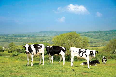
Cows on the track down to Marsh Farm near the beginning of the walk
If you enthuse about West Dorset and someone asks why it is so special, take them to Eggardon Hill. It dominates the approach to West Dorset proper, and the vistas from its 827 feet are magnificent: the Marshwood Vale is spread out before you and beyond are the wonderful West Dorset hills, from Pilsdon Pen and Lewesdon Hill round through Lambert’s and Coney’s Castles to Golden Cap and (on a good day) the sparkling sea, Shipton Hill and Eggardon’s own ramparts.
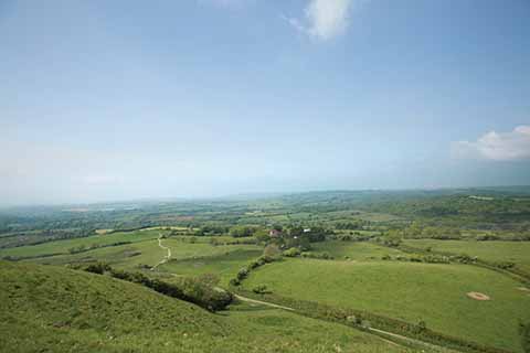
Seen from Eggardon, the sandy track on the left in the distance is the one that leads to Marsh Farm
Our ancestors appreciated the hill’s uniqueness. There are two Bronze Age burial mounds, and in about 300BC, three ramparts and two ditches were built to create a hillfort; how and when the fort was captured or abandoned is not known, as there has been comparatively little archaeological investigation of Eggardon. In Saxon times, the hundred moot, a sort of forerunner of West Dorset District Council, regarded Eggardon as a suitably prominent place to hold their twice-yearly meetings. Eight hundred years later, Isaac Gulliver who owned what is now North Eggardon Farm, is said to have planted a stand of pine trees on the hill as a seamark for his ships.
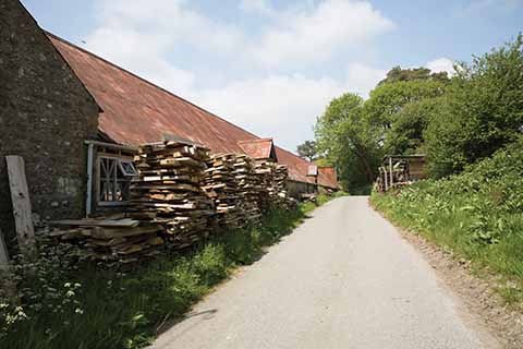
Rustic farm buildings en route
Some hills loom menacingly over the surrounding landscape, but is it fanciful to think that there is something benevolent about Eggardon’s rounded outline and pleasing shape? Despite that, the hill has more than its share of ghostly stories. Some of them may be thanks to the white deer of Eggardon: the deer in these parts have an unusually high proportion of albinos, and even the strongest sceptic, catching sight of them in the twilight, might wonder for a moment what he was seeing.
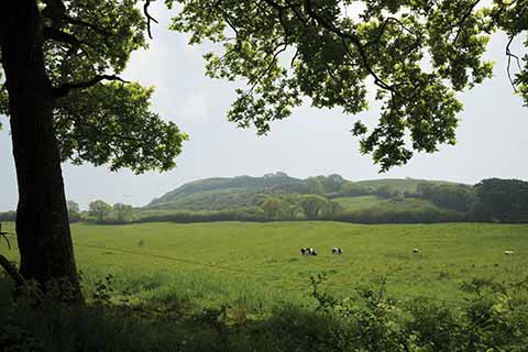
Looking back to Eggardon Hill from the track down to Marsh Farm
THE WALK
1 Walk on down the hill. In about 250 yards, as the lane bends to the right, go straight ahead on a grassy track. Stay on the track for just under a mile until it passes the not-very-attractive buildings of Marsh Farm and continues straight ahead, down the farm’s paved drive, to reach a lane. Turn left. In rather over ½ mile, just after a patch of woodland on the right, turn into an opening on the right.
2 There is a choice of two tracks: take the left-hand, which heads off across the centre of a large open field. In the next field, stay on the track as it bends to the right. The track leaves this field up a slope in the far right-hand corner. It then bends to the right, but continue straight ahead, through a gate and along the right-hand field-edge, under a pylon line. At the end of the field, go through a gate and walk down to a lane.
3 Turn left. Pass (or call in at) the Spyway Inn and in a further 100 yards turn left along the paved drive to South Eggardon House and Farm. In ½ mile, in front of a gate, go through a smaller gate on the left and walk down the field. Go through a gate at the bottom of the field and follow the path round to the left then the right, alongside a wire-mesh fence. It ascends again and bends to the right and, in less than 100 yards, to the left to reach a gate into an open field.
4 Walk up the left-hand edge of the field to a gate into a small patch of woodland. On the far side of the wood, start by following a power line, but between the first and second poles, bear left and track round the end of a hillock to go through a gate on the far side of the field. Where the path joins a track, continue in the same direction and follow the track round to the right. It then does a right-left dog-leg round the side of the buildings and becomes paved.
5 At the end of the buildings, as the drive bends to the left, turn right up a rough track. The track emerges into an open field; walk up the left-hand edge of this field and the next one. Frequent stops will be necessary not only to catch your breath but to admire the view. At the top of the second field, go through a gate and follow the chalky track that curves to the right along the bottom of the ramparts. Reaching a fence on the right, it bends to the left and starts to climb. Follow it up to a stile.
6 Immediately cross another stile on the left and continue ahead along the hill-top, roughly following the fence on the left. Go through the ramparts. You may turn right across the hill-top, but why deprive yourself of the opportunity to enjoy the views? Better to continue to where the fence disappears into some bushes and then double back along the other side of the hill. Just after entering the ramparts, turn left down a bank onto a track that leads down to a gate, cross it and walk down the lane to your car.
Distance: About 5 miles.
Terrain: The clue is in the title! Although the walk is comparatively short, its undulating nature provides plenty of exercise, especially the climb up to the top of the hill. The going underfoot is generally good.
Start: On the lane that leads down to Powerstock, about ¾ mile from the crossroads to the south-east of Eggardon Hill, there are lay-bys on either side of the road. They are much larger than the other passing places on the lane but care should still be taken not to obstruct any gates or the lane itself.
How to get there: About 2¼ miles west of the Monkey’s Jump roundabout on the western edge of Dorchester, fork right off the A35 onto a minor road. Continue across the cross-roads and, in about 3¼ miles, continue straight ahead as the road bends to the right. Continue to the cross-roads to the south-east of Eggardon Hill and go straight across, signed to Powerstock and West Milton. OS reference SY537952. Postcode (approximately) DT6 3TG.
Maps: OS Explorer 117 (Cerne Abbas & Bere Regis), OS Landranger 194 (Dorchester & Weymouth).
Refreshments: The Spyway Inn at Askerswell.
