The Dorset Walk – Daggons, Cranborne Common and Cripplestyle
Matt Wilkinson and Paul Quagliana flirt with the Hampshire border in a lesser-known corner of north-east Dorset
Published in May ’18
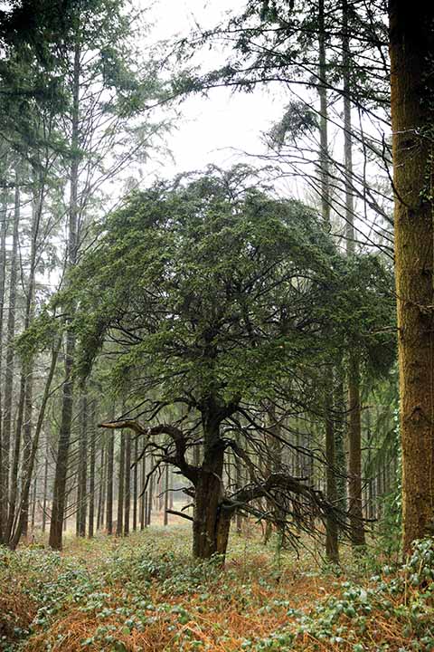
This tiny stunted tree is dwarfed by those around it
A walk that comes within a couple of hundred yards of the county boundary with Hampshire may just about be considered to be part of the New Forest, and the landscape of woods and heathland through which the route passes bears this out. It starts in Daggons, whose rather sinister-sounding name has no significance except that the Dagon family held the manor in the 14th century. The walk goes through Hither Daggons Wood and skirts Further Daggons Wood. Daggons is itself an outlier of Alderholt; in fact, the station in Alderholt was called Daggons Road. It stood on the Salisbury and Dorset Junction Railway, which before closure in 1964 ran from the cathedral city through Fordingbridge and Verwood to join the Southampton and Dorchester (‘Castleman’s corkscrew’) at West Moors. The walk crosses the route of the railway in two places.
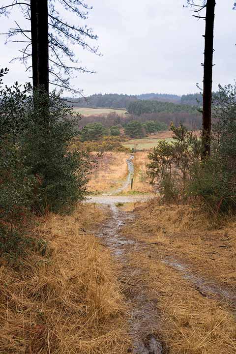
The walk opens outward to a more exposed section of walking
Cranborne Common is five miles or more from the town of that name. It is the most northerly stretch of Dorset’s heathland and here you will find not only the expected wet heathland species like heathers and bog asphodel, but rarities such as marsh gentian. Dartford warblers and nightjars may be heard, and the common also supports populations of the smooth snake and the
sand lizard.
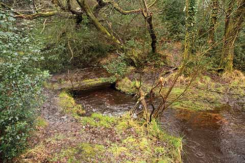
n section 2 is this bridge and the stream. The path bends left uphill
Cripplestyle has been notable for its chapels. An Ebenezer Congregational chapel was built here in 1807. In 1888, it was replaced by the Williams Memorial Chapel, named for Samuel Williams, a Welshman who was minister here for forty years. The old chapel fell down in 1976 but its site is marked by a simple memorial stone, which the walk passes. The Williams Memorial Chapel, on the main road, is now an art studio. The settlement’s distinctive name is, unusually, recorded nowhere until the 19th century. Place-name authorities suggest (without, one senses, a great deal of confidence) that its original meaning was ‘stile that could be crept through by sheep’.

Damp woodland conditions lead to some fantastic fungi
THE WALK
1 Walk into the wood and follow the track. In about 500 yards, the main track bends to the left but a grassy track continues ahead. Take this option, which soon becomes a path and emerges into an open field. Cross this and the next narrow field, aiming to the right of the farm buildings ahead. Leave the field over a stile, then turn left and immediately right on a path that runs up through a wood. At the top of the slope, cross a stile in front of Hart’s Farm and turn right onto its drive. Follow this down to a main road. Turn right, and in 20 yards left onto a broad track. In about 300 yards, as the track bends left, turn right to cross a bridge and enter woodland again.
2 The path follows the edge of the wood to reach a bridge and stile. Cross these and turn immediately left to follow a fence on the left. Cross a stile, go under a bridge carrying the track-bed of the old railway and continue in the same direction on a clear path that reaches a bridge over a little stream. Cross the bridge and follow the path as it soon bends left, uphill, and emerges from the wood. Follow the fence on the right to reach a stile at the top of a rise. Cross the stile and bear right to continue on a broad ride across Cranborne Common. Stay on the ride as it bends to the left, descends through a damp patch and rises again to meet power lines on wooden poles.
3 Here turn right up to a metal gate. Cross it and continue uphill with a fence and the power lines to the left. At the top of the rise, pick up a track and in a few yards take a path to the left, immediately under the power lines. Just after the first pole, hit a clearly defined path, where turn right. Follow the path through the trees until it reaches a track with a phone mast ahead. Here turn right. In about 400 yards, the track bends to the left, but here go straight ahead on a path which almost immediately forks. Take the left fork and follow it for about 175 yards to a cross-paths, where turn right.
4 At the next fork, fork left towards the edge of the wood and head downhill, across a track, to reach a gate into an open field. Bear slightly right to walk down the field to a gate in the far right-hand corner. Cross the former railway again, this time on an over-bridge, and go through a gate into another open field. Walk up the left-hand edge to a gate, beyond which follow a track that becomes a paved lane. Cross the main road at Cripplestyle and in 80 yards turn right on a path through the trees. When this path reaches a road, turn left and walk back to your car on the right.
Distance: About 4½ miles.
Terrain: Some well-surfaced tracks but some quite rough going with muddy patches. Stout footwear essential. No serious climbs.
Start: At the southern entrance to Hither Daggons Wood. OS reference SU093128. Postcode SP6 3DX.
How to get there: From Wimborne, take the B3078 to Cranborne (the B3081 from Shaftesbury joins the B3078 just south of Cranborne). In Cranborne, turn right on the B3078 towards Alderholt and Fordingbridge. At a cross-roads in 2½ miles, turn left, signed ‘Crendell ¾, Damerham 4’. Take the first turning on the right and park on the left in about 350 yards.
Maps: OS Explorer OL22 (New Forest), OS Landranger 195 (Bournemouth & Purbeck).
Refreshments: Nothing on the route, but pubs in Alderholt and Cranborne.
